Under Construction
SKYWARN ALERTS
EMWIN - NOAAport
PDS ALERT - PARTICULAR DANGEROUS
URGENT - IMMEDIATE BROADCAST REQUESTED Tornado Watch Number 317 NWS Storm Prediction Center Norman OK 110 PM MDT Mon Jun 12 2017 The NWS Storm Prediction Center has issued a * Tornado Watch for portions of Northeast Colorado Western Nebraska Panhandle Southeast Wyoming * Effective this Monday afternoon and evening from 110 PM until 800 PM MDT. ...THIS IS A PARTICULARLY DANGEROUS SITUATION... * Primary threats include... Several tornadoes and a few intense tornadoes likely Widespread large hail expected with scattered very large hail events to 4 inches in diameter likely Isolated significant damaging wind gusts to 75 mph possible SUMMARY...Isolated intense supercell thunderstorms are expected to develop across the watch area this afternoon. Giant hail and strong tornadoes will be possible in the most intense storms. The tornado watch area is approximately along and 60 statute miles east and west of a line from 50 miles north northeast of Douglas WY to 55 miles southeast of Fort Collins CO. For a complete depiction of the watch see the associated watch outline update (WOUS64 KWNS WOU7). PRECAUTIONARY/PREPAREDNESS ACTIONS... REMEMBER...A Tornado Watch means conditions are favorable for tornadoes and severe thunderstorms in and close to the watch area. Persons in these areas should be on the lookout for threatening weather conditions and listen for later statements and possible warnings. && OTHER WATCH INFORMATION...CONTINUE...WW 316... AVIATION...Tornadoes and a few severe thunderstorms with hail surface and aloft to 4 inches. Extreme turbulence and surface wind gusts to 65 knots. A few cumulonimbi with maximum tops to 500. Mean storm motion vector 24030. ...HartRead more ]]>
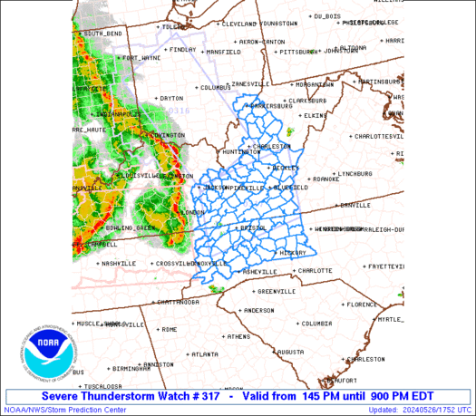
STORM PREDICTION CENTER - PRODUCTS

Day 1 Convective Outlook NWS Storm Prediction Center Norman OK 0726 AM CDT Thu Jul 20 2017 Valid 201300Z - 211200Z ...THERE IS A SLIGHT RISK OF SEVERE THUNDERSTORMS THIS AFTERNOON INTO EARLY TONIGHT FROM PARTS OF ILLINOIS TO WESTERN NEW YORK... ...THERE IS A SLIGHT RISK OF SEVERE THUNDERSTORMS THIS AFTERNOON/EVENING FOR THE NORTHERN HIGH PLAINS... ...THERE IS A MARGINAL RISK OF SEVERE THUNDERSTORMS IN A BROAD AREA FROM PARTS OF NEW ENGLAND TO THE MIDWEST AND NORTHERN PLAINS... ...SUMMARY... A few severe storms with wind or hail are possible across the northern High Plains, and from parts of the Midwest into the Northeast this afternoon. ...Lower Great Lakes into New England this afternoon... A midlevel shortwave trough over the upper Great Lakes this morning will reach the Saint Lawrence Valley by this evening, along with an associated/weak surface cold front. Boundary-layer dewpoints increasing into the upper 60s and surface heating within cloud breaks downstream from the northern IL MCS/cloud debris will drive sufficient buoyancy for strong updrafts this afternoon. As evidenced by the convection now forming over Lake Huron, thunderstorms should form over or move into western NY by early afternoon. An increase in deep-layer vertical shear with the approach of the midlevel trough and MLCAPE of 1000-2000 J/kg will support a threat for damaging gusts with organized cells/clusters this afternoon. ...OH Valley/Upper Midwest through tonight... An ongoing MCS over northern IL has been maintained by a moisture feed from IA in a warm advection regime above the cold pool of an earlier MCS that dissipated over northern IN last night. The IL MCS will continue moving to the southeast this morning, but should weaken slowly as warm advection diminishes and the associated midlevel trough moves eastward over MI. Some additional storm development may occur along the outflow boundaries and in conjunction with a residual MCV from the overnight storms, though lingering clouds and minimal forcing for ascent cast doubt on the extent of afternoon convection toward IN/OH. Instead, renewed thunderstorm development could be delayed until this evening along the outflow-reinforced cold front from IL into IA, with storms expected to move southeastward into tonight. Damaging winds and isolated large hail will be the main threats. ...Northern High Plains area this afternoon into tonight... A midlevel trough over the Pacific Northwest will crest the flattened ridge over the Rockies and reach the northern High Plains tonight. Associated lee cyclogenesis is expected across eastern MT, with a lee trough extending southward across the High Plains. Residual boundary-layer dewpoints ranging from the 60s in western SD to the 50s near the ND/MT border will combine with strong surface heating and steep midlevel lapse rates to boost MLCAPE into the 1500-2500 J/kg range as convective inhibition weakens along the lee trough. The initial widely scattered storms could be supercells capable of producing large hail and damaging winds, given the moderate buoyancy, somewhat high cloud bases and effective bulk shear of 35-45 kt (especially from northwest SD into eastern MT). Convection could grow into a cluster or two and persist into tonight with a marginal wind/hail risk. Otherwise, a few strong storms may occur this afternoon/evening with the lingering MCV from overnight convection in NE, and in a developing warm advection regime late tonight toward eastern ND. ..Thompson/Kerr.. 07/20/2017Read more ]]>
Emergency Managers Weather Information Network - Overview

Welcome to the Emergency Managers Weather Information Network - NOAAport satellite warning system.
The Emergency Managers Weather Information Network - NOAAport system is a NOAA based satellite data-stream feed
that is COST-FREE ($) in subscription services. Paid for by the US taxpayer, the Emergency Managers Weather Information Network (EMWIN) and NOAAport system offers real time weather conditions, storm damage reports, high seas forecast,
tornado, severe thunderstorm watch and warning reports, and Dept. of Homeland Security civil emergency messages when they occur in real time, from any National Weather Service forecast office. When a tornado warning is issued from the National Weather Service, EMWIN transmits the warnings in real time issuance from its up-link facility at Wallops Island, Virginia. End users such as municipalities, police and fire services, hospitals, TV stations, and other broadcast media that have a EMWIN receiver installed at their locations, are kept up-to-date in warning the general public and preparations for response are under way sooner as opposed to later. End users only invest in purchasing of the equipment to own, in this subscriber cost free service.
The EMWIN satellite warning system is an advanced warning datastream transmitted via GOES-East and GOES-West satellites. End users can customize distribution of pre-selected messages and warning to pagers.
